
Circumnavigate Shenandoah National Park and experience the storied history and scenery of the Hills & Hollows of the Blue Ridge.
Digital Maps of the 300-mile Hills and Hollow Route and its alternates are on Ride with GPS, a great planning resource also offering a mobile app and GPX files for export (see Planning).


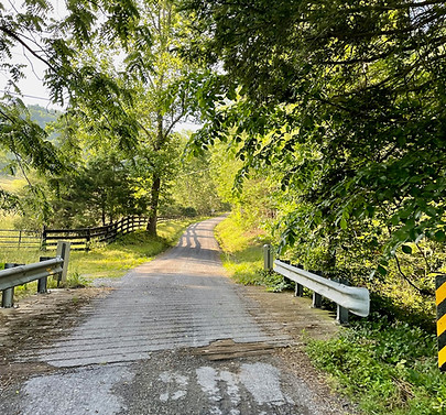
Hills and Hollows, Skyline Drive
& the Old Roads of the Blue Ridge
A network of exploration around Shenandoah National Park
The following alternate routes offer ideas for unique extensions beyond the 300-mile Blue Ridge Hills & Hollows circuit. Combine the loop with Skyline Drive within the Shenandoah National Park, take the adventurous Veach Gap alternate route from Front Royal into Fort Valley, or add exploratory sections on Old Gravel Roads from the loop to the park boundary.

Skyline Drive
105.2 miles / 9,846 feet (mile 111 & 246)
Ride the 105-mile iconic Skyline Drive through Shenandoah National Park. This paved road is the classic driving route from end to end, best approached from the southern park entrance at Rockfish Gap for a northbound ride. Tack on to the Hills & Hollows loop, or mix and match the east or west half!

Veach Gap Alternate
20.1 miles / 2,404 feet (mile 113)
Adds 2.2 miles and 938' climbing.
Compare to the same section of the main route.)
This rugged and adventurous alternate route crosses Veach Gap on a historic wagon road and adds a free PATC shelter & legal camping options in George Washington National Forest. The tradeoff is a few miles of hike a bike over the gap on single and doubletrack trails, all of which are legal for bicycles. See photos of trail surface before committing to this alternate route.
Old Gravel Roads Over the Blue Ridge

The following routes offer exploration off the Hills & Hollows circuit to get closer to the boundary of Shenandoah Park by utilizing old passages to the mountain from before the park was created. All of these routes are legal to ride with a bicycle and do not enter SNP, with a turn-around at the park boundary sign. With an entry pass to Shenandoah National Park, park access by foot is permitted from the boundary.
These routes are mostly gravel except for Tanners Ridge and Beldor Hollow. The Simmons Gap route is an alternate rather than an out-and-back; the rest turn around at the SNP boundary. Be warned that most are challenging climbs!

Graves Mill / Conway Fire Road
25.6 miles / 3,160 feet - Out-and-Back (mile 13)
From the Wolftown Mercantile and Country Store, head northwest to the Graves Mill Historical Park, featuring a replica of the 1900s post office building! Continue up into the Rapidan Wildlife Management Area on gravel roads, following winding and rugged surfaces that connect to the Conway River Fire Road up to the SNP boundary. Rapidan WMA require a free permit for access and camping, which can be obtained on their website.

Rapidan Road
15.2 miles / 2,093 feet - Out-and-Back (mile 28)
Connect in on Quaker Run Road near the Graves Mountain lodge and campground to enter the Rapidan WMA from the southeast and follow the Rapidan River up to the SNP boundary and gate, posted with a "no bicycles" symbol. Within SNP, another mile on foot following this road reaches Camp Hoover (Rapidan), where President Herbert and Lou Henry Hoover created a private retreat in the early 1900s. The road continues uphill to Big Meadows on Skyline Drive.

Tanners Ridge
12 miles / 1,934 feet - Out-and-Back (mile 168)
Tanners Ridge Road connects the town of Stanley to the Big Meadows area of Shenandoah National Park. Climb steeply out of the valley on this road that is well traveled by park employees. At the gated park boundary (signed no bicycles, but foot traffic permitted), pavement turns to dirt and continues up past the Tanners Ridge Cemetery to reach Skyline Drive. Park employees have gate access and often drive this direct route to the Big Meadows complex.

Naked Creek
12.8 miles / 1,188 feet - Out-and-Back (mile 186)
Follow the Naked Creek up from Furnace into Jollet past a network of communities to the steep gravel road up to the Meadow School Trailhead (to Bearfence Mountain). The Naked Creek flows into the South Fork of the Shenandoah River just south of the town of Shenandoah, VA.
Beldor Hollow
15.1 miles / 1,305 feet - Out-and-Back (mile 192)
Just south of Swift Run (Rt. 33) and the town of Elkton, a journey into the Beldor Hollow makes a great standalone ride into a rural community surrounded by national park land. The route is mostly paved with a short gravel section after the bridge over Hawksbill Creek to the park boundary. Beldor Road connects over the Blue Ridge at Simmons Gap (past the ranger Station) down to the Mission Home area on the eastern side.

Jarmans Gap
6.7 miles / 1,598 feet - Out-and-Back (mile 257)
Challenge your legs on the iconic gravel climb up towards Jarmans Gap (where the historic Three-Notch’d Road crossed the Blue Ridge). The climb steeply rises 1,600 feet at an average 10% grade over 3 miles. The route flattens near the top at the park boundary gate, located less than 0.2 miles from Skyline Drive with a “no bicycles” sign posted.

Simmons Gap / Wyatt Mountain
9.9 miles / 1,605 feet - Alternate (mile 282)
Adds 2.2 miles and 1350' - Compare to ridewithgps.com/routes/44253003?highlight=26051-26745
From Mission Home, climb up the historic Simmons Gap road to the park boundary, then detour back down Wyatts Mountain to rejoin the main route farther northeast in Dyke at Maybelle’s Market. This alternate route passes Flattop Mountain, the Shifflett family cemetery, Stone Mountain Vineyard, and the Blue Ridge School.
